
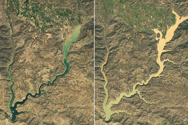
Satellite images show Navajo Reservoir swelling 60 feet in just six weeks after extreme storms
Original headline: Water Surges Into Navajo Reservoir — science.nasa.gov
More in Defense and aerospace news
NASA's Landsat 9 satellite captured dramatic changes in Navajo Reservoir between September and November 2026, showing the lake level rising nearly 60 feet (18 meters) following back-to-back extreme rain events in the Four Corners region. The U.S. Army Corps of Engineers data reveals the reservoir went from holding just 60% of its average capacity to 108% in that short period, marking its highest level since August 2019 after minimal growth during the previous snow drought winter.
The satellite imagery provides crucial visual evidence of how extreme weather events can rapidly transform water resources in drought-prone regions. While the storms alleviated short-term drought conditions, they also triggered record river levels and damaging floods in communities like Pagosa Springs, Colorado, where the San Juan River nearly reached its 1911 record flood level. This NASA Earth Observatory data highlights the increasing volatility of water resources in the Southwest and demonstrates how satellite monitoring helps track these rapid environmental changes for emergency response and water management planning.
Read the original at science.nasa.gov
Satirical commentary on real tech news, summarised with AI. Read the original source for the facts. How ZeroDaily works